* The author is part of the community of readers of La Vanguardia
I am going to show you in Las Fotos de los Lectores de La Vanguardia a really beautiful place both for its views and its waters, a route that I did together with my fellow excursionists.
To begin with, we are on the map, we are in the Sierra de Huétor Natural Park, in the province of Granada, a set of medium-height mountain ranges that are located about 20 kilometers north of the capital of Granada.
In that place, narrow ravines, streams and pits alternate, forming a complex relief due to the limestone nature of the terrain, which determines the abundance of karstic formations. In them, the water filters into the bowels of the mountain, creating galleries and caves where it accumulates.
Later, it will emanate in the form of springs as it happens in Fuente Grande. Two of the rivers that run through these places are the Darro and the Fardes, where trout exists in the latter.
Our route was through the ridge that joins the Peñón de la Cruz with its 2027 meters of altitude and the Peñón de Majalijar at 1878 meters. Under these masses we contemplate a beautiful forest where an extensive pine forest is mixed with a beautiful holm oak.
The views from here looking south are impressive, we can see the entire Sierra Nevada massif, and recognize all its peaks still covered in snow.
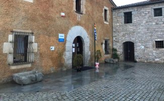
At the end of this route through the crests, where the heat became a bit heavy despite the height, we gave ourselves a small tribute by visiting Prado Negro.
This place is a place of peace and relaxation, it is a district belonging to the municipality of Huétor Santillán. There we find a beautiful place with streams and waterfalls, some with waterfalls of up to 11 meters, surrounded by large oaks and the incessant song of birds.